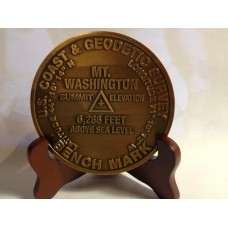
Mount Washington Summit Marker
The highest peak in the Northeastern United States at 6,288 ft (1,917 m) and the most prominent mountain east of the Mississippi River. It is famous for dangerously erratic weather. For 76 years, until 2010, a weather observatory on the summit held the record for the highest wind gust directly measured at the Earth's surface, 231 mph (372 km/h or 103 m/s), on the afternoon of April 12, 1934.Before European settlers arrived, the mountain was known as Agiocochook, or "Home of the Great Spirit".
The mountain is located in the Presidential Range of the White Mountains, in the township of Sargent's Purchase, Coos County, New Hampshire. While nearly the whole mountain is in the White Mountain National Forest, an area of 59 acres (0.24 km2) surrounding and including the summit is occupied by Mount Washington State Park.
The summit station of Mount Washington has an alpine climate or tundra climate , though warming to a subarctic climate with lower elevation, although it receives an extremely high amount of precipitation, atypical for most regions with such cold weather.
The weather of Mount Washington is notoriously erratic. This is partly due to the convergence of several storm tracks, mainly from the Atlantic to the south, the Gulf region and Pacific Northwest. The vertical rise of the Presidential Range, combined with its north-south orientation, makes it a significant barrier to westerly winds. Low-pressure systems are more favorable to develop along the coastline in the winter months due to the relative temperature differences between the Northeast and the Atlantic Ocean. With these factors combined, winds exceeding hurricane force occur an average of 110 days per year. From November to April, these strong winds are likely to occur during two-thirds of the days.
The mountain is part of a popular hiking area, with the Appalachian Trail crossing the summit and one of the Appalachian Mountain Club's eight mountain huts, the Lakes of the Clouds Hut, located on one of the mountain's shoulders. Winter recreation includes Tuckerman Ravine, famous for its Memorial Day skiing and its 45-degree slopes. The ravine is notorious for its avalanches, of which about 100 are recorded every year, and which have killed six people since 1849. Many hikers have died on the mountain in all seasons, due to harsh and rapidly changing conditions, as well as inadequate equipment, failing to plan for the wide variety of conditions which can occur above tree line, and poor decisions once the weather began to turn dangerous.
The most popular hiking trail approach to the summit is via the 4.1-mile (6.6 km) Tuckerman Ravine Trail. It starts at the Pinkham Notch camp area and gains 4,280 feet (1,300 m), leading straight up the bowl of Tuckerman Ravine via a series of steep rock steps which afford spectacular views of the ravine and across the notch to Wildcat Mountain.

